Natchez Trace Parkway by RV: Campgrounds and Rules

In this guide
The Natchez Trace Parkway is one of the easiest long drives in the national park system for an RV, as long as your rig is 55 feet or shorter including the tow vehicle and no taller than 14 feet. It runs 444 miles from Natchez, Mississippi, to near Nashville, Tennessee, with a 50 mph limit, no trucks, and three free, first-come campgrounds spaced roughly a day’s easy drive apart. What it lacks is services: the campgrounds have no hookups, no showers and no dump stations, and one of them has no drinking water.
This guide sets out the National Park Service’s size and hauling rules, the pullouts you cannot use, each campground, and the two 2026 closures with their detours. Figures are from the parkway’s RV page, camping page, FAQ and road and site status page, read October 28, 2026.
The rules at a glance
| Rule | What the NPS says |
|---|---|
| Maximum length | 55 ft including the tow vehicle |
| Maximum height | 14 ft |
| Weight | The parkway “can accommodate an RV weighing up to 40,000 pounds” |
| Speed limit | 50 mph unless otherwise posted |
| Lane width | 11 ft, little to no shoulder; cyclists may use the full lane |
| Commercial vehicles | Prohibited; buses need a permit (662-680-4014) |
| Hauling | Recreational only: camper trailers, boats, horses, ATVs, bikes, antique cars, tractors |
| Camping | Only in the three campgrounds; no dispersed camping |
| Fees | None for the road or the campgrounds |
The length rule is a combined figure. A 40-foot motorhome towing a car that adds 16 feet hitch to bumper is over. For a truck and fifth wheel, measure bumper to bumper with the rig hitched rather than adding brochure lengths, since the overlap at the hitch changes the total. Our sister site’s RV length classes guide explains why the advertised length of a trailer is rarely its real length.
The commercial ban is why the parkway feels empty. There are no log trucks or delivery vans, which makes the 11-foot lanes much less tense than they sound. The flip side is the hauling rule: a trailer full of goods for a business is commercial, and the NPS says only recreational hauling is allowed.
Height: 14 feet, with lower spots
The parkway’s own height cap is 14 feet, and the FAQ says minimum parkway bridge clearances are 14 feet except on the access roads to Jackson Falls and Mangum Mound. The RV page adds a table of clearances under 15 feet at five mileposts:
| Milepost | Clearance | Crossing road |
|---|---|---|
| 66.6 | 14 ft 8 in | MS Highway 27 |
| 118.9 | 14 ft 7 in | Beall Road |
| 120.8 | 14 ft 1 in | Rocks Road |
| 416.3 | 14 ft 10 in | Old Trace Drive |
| 419.1 | 14 ft 7 in | Old Trace Drive |
The table does not say whether those heights are for traffic on the parkway or on the crossing road, and we could not confirm which. Either way they are above the 14-foot rule, so a rig that obeys the rule clears them. The bigger risk is off the parkway: the NPS warns that county roads passing under the parkway at exits can be low, that it does not have a full list, and that RVers should consult a motor carrier atlas before leaving the parkway on a back road. Mangum Mound’s access has an 11-foot 6-inch bridge, which is why its pullout is closed to RVs.
Pullouts closed to RVs
The NPS lists six pullouts that are closed to RVs:
- Milepost 17: southern trailhead for the Potkopinu section of the national scenic trail
- Milepost 45: Mangum Mounds (bridge clearance 11 ft 6 in)
- Milepost 278.4: Twenty-mile Bottom Overlook
- Milepost 375.8: Old Trace Drive
- Milepost 394: Devil’s Backbone State Recreation Area
- Milepost 401.4: Old Trace Drive
One more trap near the southern end: when the Mount Locust historic site (milepost 15.5) is closed, its circular drive is closed too, and the park says there is then no easy place for an RV to turn around. Check the site’s hours before you drive north from Natchez expecting to stop there.
The three campgrounds
All three are run by the NPS, free, open all year and first-come, with pull-through and back-in sites. None has hookups, showers or a dump station, and the campground regulations prohibit connecting to campground water or electric. Every tire must stay on the pavement, two pets per site at most, on a leash no longer than 6 feet.
| Campground | Milepost | Sites | Water | Restrooms | Cell signal | Nearest city |
|---|---|---|---|---|---|---|
| Rocky Springs (MS) | 54.8 | 22 | Not potable | Intermittent | “Bad, if any” | About an hour from Natchez and from Jackson |
| Jeff Busby (MS) | 193.1 | 18 | Potable, year-round | Flush, year-round | Yes | About 1.5 hours south of Tupelo |
| Meriwether Lewis (TN) | 385.9 | 31 | Potable, year-round | Flush, year-round | Depends on carrier | Closest to Nashville; Hohenwald address |
Sources: NPS camping and road status pages and the NPS campground data, October 28, 2026.
Rocky Springs, near the southern end, sits beside the site of an abandoned town, with a stretch of the Old Trace and walking trails. Its comfort station water is listed as non-potable, so arrive with a full fresh tank and plenty of drinking water.
Jeff Busby, roughly midway, is the smallest at 18 sites, with an overlook on Little Mountain, flush toilets and drinking water all year.
Meriwether Lewis, the largest and the nearest to Nashville, surrounds the monument and gravesite of the explorer, with exhibits, picnic areas and a walkable section of the Old Trace. It has a campground host in season. Its GPS address is 190 Meriwether Lewis Park, Hohenwald, Tennessee.

Getting a site
There are no reservations, so timing is everything. The NPS says the campgrounds fill quickly in March and April and in October and November, and are busiest on holiday weekends. Arrive early in the afternoon midweek in those months, and have a backup for the night. Our guide to first-come campgrounds in national parks covers timing and etiquette for no-reservation sites.
Stay limits disagree. The camping page says 14 days per campground per calendar year; the FAQ says 14 consecutive nights. Plan on the calendar-year rule.
No dump stations: plan your tanks
Three free campgrounds with no dump station on a 444-mile road means planning tank capacity. A couple dry camping for two or three nights at a time can usually manage, but you will need to leave the parkway to dump. Our national park dump stations guide covers how park dumps work, and RV Camp Atlas explains how to use an RV dump station if a town or state park station is new to you. If you need hookups, the NPS suggests other campgrounds along the parkway; state parks and Corps of Engineers lakes near the route are covered in our upcoming state parks near national parks roundup.
2026 closures and detours
The road and site status page listed two closures on October 28, 2026:
Mileposts 135 to 159.5, Mississippi (Leake and Attala counties). Closed from August 3, 2026, for full-depth road reconstruction, bridge repairs and paving, with the detour expected to stay in place for three to four months and the wider project running to mid-2027. It is phase two of an 83-mile reconstruction. The detour uses Mississippi Highways 16, 25, 35 and 19 and adds about 11 minutes.
- Northbound: exit left at milepost 135, right on Highway 16 East for 5 miles, left on Highway 25 North for 7.5 miles, right onto Highway 35 North and continue about 20 miles, then turn right back onto the parkway.
- Southbound: exit right at milepost 160, left on Highway 19/35 South for 20 miles, continue on Highway 35 South, exit right on Highway 25 South for 7.5 miles, right on Highway 16 West for 5 miles, and use the second parkway entrance.
Mileposts 437 to 440, Tennessee (Williamson County). Closed from April 2026 to about May 2027 while a permanent safety barrier is built on the Double Arch Bridge and the bridge is repainted. Northbound, exit at milepost 437, turn left on TN-96 West for 3.5 miles, then right on TN-100 East for 3.5 miles to the northern terminus. You can still drive in from the northern terminus to Big Tree Overlook (milepost 440) and back.

Also closed indefinitely: the Parkway Information Cabin at milepost 102.4 in Ridgeland; its parking lot still serves the multi-use trail. The main Parkway Visitor Center near Tupelo is open 9 a.m. to 4:30 p.m. daily and closed on Thanksgiving, December 25 and January 1.
How long it takes
The NPS budgets at least 10 hours of driving from Natchez to Nashville at parkway speeds, about 3.5 to 4 hours from Tupelo to Jackson, 4 to 4.5 hours from Tupelo to Nashville and 5.5 to 6 hours from Tupelo to Natchez. In an RV, with stops, most people spread it over three to five days, and the campground spacing suggests a natural plan:
- Natchez to Rocky Springs (milepost 54.8): a short first day with time for Mount Locust.
- Rocky Springs to Jeff Busby (193.1): the long Mississippi middle, including the reconstruction detour in late 2026.
- Jeff Busby to Meriwether Lewis (385.9): through Tupelo, the visitor center and the corner of Alabama.
- Meriwether Lewis to Nashville: the hilliest stretch, with the Double Arch Bridge closure at the end.
If you are building a longer Appalachian or Southern loop, the Blue Ridge Parkway RV guide is the other NPS parkway, and its tunnels are far stricter on height than anything on the Trace.
When to go
Spring and fall are the busy seasons; the NPS says the campgrounds fill fastest in March, April, October and November and notes that more cyclists ride the parkway then. Summer in Mississippi is hot and humid at campgrounds with no electricity; a site in the shade and a plan for running fans off batteries matter more than usual. Winter is quiet and the campgrounds stay open, but check the road status page after storms.
Mistakes to avoid
- Adding up the brochure lengths. The 55-foot limit is the whole combination, measured.
- Pulling into a no-RV pullout. Six are listed, and backing a trailer out onto the parkway is the alternative.
- Following a back road off the parkway without checking clearance. Low county underpasses are the NPS’s own warning.
- Expecting water at Rocky Springs. It is non-potable; arrive self-contained.
- Arriving late on an October Saturday. First-come sites fill fast in spring and fall.
- Passing cyclists in a tight spot. The lanes are 11 feet and cyclists may use the whole lane; wait for a clear oncoming lane.
Gear that helps on this drive
As an Amazon Associate we earn from qualifying purchases.
 Reliance Aqua-Tainer 7-gallon water container: Rocky Springs has no drinking water, and a couple of jugs cover cooking and drinking for a night or two.
 Camco Rhino 21-gallon portable tote tank: with no dump stations on the parkway, a tote buys an extra night before you leave the route to empty tanks.$209.99Price as of November 16, 2026, 9:59 AM ET. Prices and availability are accurate as of the date/time indicated and are subject to change.
- VTOMAN Jump 600X portable power station: none of the three campgrounds has electricity, and a power station runs fans and charges phones quietly.
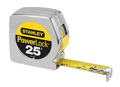 Stanley 25 ft tape measure: measure your full length and height before you trust the 55-foot and 14-foot limits.
Rules, campground details and closures in this guide were read from NPS pages on October 28, 2026. The status page is updated as projects move, so check it before you set out.
Frequently asked questions
Can you drive an RV on the Natchez Trace Parkway?
Yes. The National Park Service allows RVs up to 55 feet long including the tow vehicle and up to 14 feet tall, and its campground listings say the parkway can carry an RV weighing up to 40,000 pounds. The road has 11-foot lanes with little or no shoulder, a 50 mph speed limit unless posted lower, and six pullouts that are closed to RVs.
Are the Natchez Trace campgrounds free?
Yes. Meriwether Lewis (milepost 385.9), Jeff Busby (193.1) and Rocky Springs (54.8) charge no fee and take no reservations. They are primitive: no electricity, no showers and no dump stations, and connecting to campground water or power is prohibited. They are open all year and fill quickly in March, April, October and November.
Is there drinking water at the Natchez Trace campgrounds?
At Jeff Busby and Meriwether Lewis, yes, year-round. At Rocky Springs the NPS says the comfort station water is non-potable and campers should plan to be self-contained; restrooms there are open intermittently.
Are commercial vehicles allowed on the Natchez Trace Parkway?
No. The NPS prohibits commercial vehicles and allows only recreational hauling: camper trailers, boats, horses, ATVs and similar may be carried for recreational use only. Buses need a permit, arranged by phone with the parkway (662-680-4014).
How long can you stay at a Natchez Trace campground?
The NPS camping page sets the limit at 14 days per campground per calendar year; an older FAQ page says 14 consecutive nights. Plan on the stricter calendar-year rule. Dispersed camping is not allowed anywhere on the parkway.
Is the Natchez Trace Parkway closed anywhere right now?
As of October 28, 2026, two sections were closed: mileposts 135 to 159.5 in Leake and Attala counties, Mississippi, for road reconstruction expected to last into late 2026, and mileposts 437 to 440 near the Double Arch Bridge in Tennessee until about May 2027. Both have signed detours; the Mississippi one adds about 11 minutes.
Keep planning
- Acadia RV Camping Including Schoodic Woods
Acadia RV camping: Blackwoods and Seawall's 35-foot sites, Schoodic Woods' electric loop for rigs to 70 feet, Park Loop Road bridge heights and the Cadillac rule.
Updated Oct 2026 - Arches and Moab RV Camping: Where Rigs Actually Fit
Arches and Moab RV camping: Devils Garden's per-site limits up to 40 feet, no timed entry in 2026, $20 BLM campgrounds, Dead Horse Point hookups and where to dump.
Updated Oct 2026 - Assateague Island RV Camping: National vs State Park
Assateague Island RV camping: NPS Oceanside and Bayside sites vs the state park's 30-amp loops, the Virginia side's no-camping rule, fees and OSV closures.
Updated Oct 2026